Our website uses affiliate links. If you click through any of these affiliate links in this article to make a purchase, we may earn a small commission at no extra cost to you. As Amazon Associates, we earn from qualifying purchases. Read our Disclosure for more. Thanks for your support!
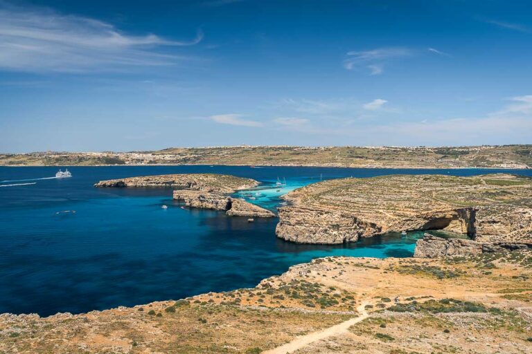
Malta may be famous for its wonderful capital Valletta and gorgeous beaches, but there are also less-travelled places in this amazing island country, such as the Xemxija Heritage Trail.
Part of the Pilgrim’s Way To The Sanctuary of Our Lady in Mellieha, the Xemxija Heritage Trail is one of many sites of archaeological importance on the island of Malta. The prehistoric ruins and Punic tombs found along the trail are evidence that Xemxija Hill was inhabited long before the Romans built the road that’s now turned into a walking trail.
The short hike along this 2000-year-old Roman road walks you through Malta’s history. In this article, you’ll find all the information you need to enjoy this fantastic hike to the fullest.
If you’re considering a trip to Malta soon, we’re here to answer all your questions.
Click here to book a 60-minute video call with us or purchase a travel planning bundle that consists of a video call and a Malta itinerary, customised to your travel needs and desires.
Learn more about our travel planning services.
Is The Xemxija Heritage Trail Easy?
The Xemxija Heritage Trail is an easy hike, ideal for beginners. The path is more like a narrow dirt road. After all, this was a road the Romans constructed and it was considered pioneering at the time.
As the trail is on Xemxija Hill, it starts with a short uphill walk until you reach the top. After that, the hike is mostly flat. At some point, you have to walk on flattened rocks but nothing too strenuous. The trail is well-marked and you’re unlikely to get lost.

There’s no shade along the trail, so it’s a good idea to visit early in the morning or in late afternoon. We visited Malta in spring, so we hiked the trail just before sunset on a very hot day in late April. It took us about one hour to one hour and a half with several stops for photos and videos.

Do I need a Map of The Xemxija Heritage Trail?
No, you don’t need a special map, Google Maps will do. We used Google Maps which helped us find all the main attractions along the Xemxija Heritage Trail. However, when we walked the trail, some sights, like the Cave of the Galley, weren’t easy to find. Probably because the spot was overgrown and neglected. Below, we’re sharing Google Maps links to all points of interest mentioned along the trail.
How To Get To The Starting Point
Although we were on a Malta road trip when we decided to hike the Xemxija Heritage Trail, we didn’t drive to the starting point but used public transport instead as buses were frequent and we were eager to leave the car after a long day driving around Malta. However, if you’re exploring the north of Malta by car, there is enough parking space near the trail’s starting point.

We took the bus from Mellieha but there are also frequent buses from Valletta and St. Paul’s Bay to Xemxija Bay. The Xemxija Heritage Trail’s starting point is a few minutes walk from the Roti bus station on the seaside road along Xemxija Bay. Once you get off the bus, you’ll soon come across a street sign to the Roman Road. The walk to the starting point is quite uphill but short.
Location of the starting point on Google Maps

What To See Along The Xemxija Heritage Trail
Along the trail, there are over 20 attractions that date back to various periods. However, in this article, we’re focusing on the main sights, as these were the ones we visited, too. The reason is that we started walking the trail just before sunset. Therefore, we didn’t have enough time to check out all the sights.
1. Punic-Roman Apiary
After a short uphill walk from the starting point, the first impressive attraction is one of the area’s ancient apiaries. An island renowned for its first-class honey production, Malta used to be called Melita, a name originating from the Latin word for honey.
The apiary probably dates back to the Punic-Roman era. You can go behind the apiary’s symmetric facade to see how an ancient apiary with terracotta beehives looks from the inside.

2. Old Carob Tree
Just around the corner from the Roman Apiary, you’ll see an ancient tree. According to the poem carved by Frans Scerri on the dry stone wall below this amazing tree, the carob tree might be one thousand years old.

Behind the tree, a sign indicates yet another apiary that used to be a burial site in Roman times. Likewise, the cave next to the tree was used for burial purposes.

Once you’ve passed the burial cave, you will see a few crosses carved on the rock by the pilgrims on their way to Mellieha.

3. Punic Shaft Tomb
At that point, the path has already become flat as you’ve reached the top of the hill. There, you will see a marked intersection. On the left, the path leads to the Neolithic temples’ remains and then to the woodlands. We walked to the temples’ ruins but there wasn’t much to see, so we walked back and continued our way towards the Punic shaft tomb.
The first historic site on the way is a one-of-a-kind Punic shaft tomb dating back to 500 BC. It was probably used by the Phoenicians and Carthaginians.

4. Farmer’s Hut
A few steps from the shaft tomb is a roofless farmer’s hut reconstructed with the original large stones. The hut was probably an extension to the caves next to it. The rubble walls, outside stone bench, oil lamp niche and outside staircase are some of the things that will give you a glimpse of what life must have been like in the past.

5. Cave Dwellings
Right next to the farmer’s hut, the cave dwellings date back to Punic times. Families with their animals used to live in those caves until the 1930s. The most interesting part of those caves is the evidence of how people had found a way to prevent rainfall from getting into the cave by digging channels in the rock. Before the caves were inhabited, they were burial sites while, during the war, they were shelters.

6. Old Roman Well/Silo
Near the caves, you will see a grain silo from the Roman period that was later converted into a well. If you want to hike a bit more, this area is full of Neolithic tombs.

7. World War II Military Pillbox
After the well/silo, walk back to the intersection before the Punic shaft tomb and turn right. Pass through the drawbar for vehicles and soon you will reach a World War II Military Pillbox. Similar military pillboxes are scattered across the country.
Keep in mind that you can’t enter the pillbox. From the Military Pillbox, a downhill path leads to the Roman Baths, if you have more time for exploration.

8. Cart Ruts
Our last stop on the Xemxija Heritage Trail was the Cart Ruts near the military pillbox. Similar to the Clapham Junction Cart Ruts, one of the best places to visit in Malta, these cart ruts were carved into the limestone, possibly for transferring carts across the Maltese islands.

A few steps from the cart ruts, you’ll find the asphalt road that will lead you back to Xemxija Bay.

Thank you for joining us on this walk along the Xemxija Heritage Trail in Malta. If you feel like an easy hike during your trip to Malta, this trail is a great opportunity to enjoy a pleasant walk while learning more about Malta’s past and taking in nice panoramic views along the way.
WORDS & IMAGES: Katerina
EDITING: Maria